Overview
- 3D Modeling and Survey
- Survey Date: November 2017
- Client: Surveyor Biagio Siciliani
- Location: Fuscaldo (CS)
- Purpose: to create 3D model for metric analysis & BIM planning
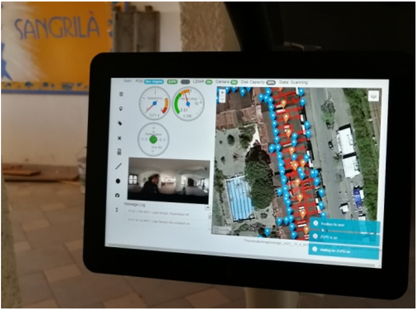
TIMMS initialization stage.
SURVEY OBJECTIVES
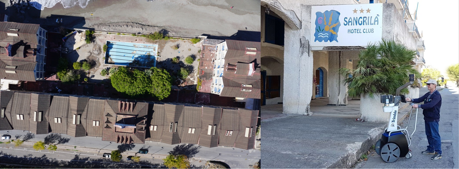
Hotel Club Sangrilà is a tourist complex which became a very famous destination in Calabria in the 1980s. The facility has been closed for about 10 years, but the need to restructure and restore it recently emerged. The first requirement was to carry out 3D mapping of both the inside and outside, in order to reconstruct the three-dimensional model of the entire facility. Given the extensive and complex nature of the survey area that was to be completed in a relatively short timeframe (three buildings with various underground spaces, plus all of the exterior, for a total of approximately 30,000 square meters), Surveyor Biagio Siciliani and Engineer Giacomo Siciliani, in partnership with Engineer Maria Rosaria Mangialavori and the firm DR-One S.r.l., decided to first survey the area by drone. This enabled them to map the roofs of the buildings and to plan a 3D laser scanner survey using Trimble’s Indoor Mobile Mapping Solution, otherwise known as TIMMS.
SYSTEM DESCRIPTION
TIMMS is the ideal tool for the acquisition of 3D geospatial data from a building’s interior and exterior, as well as from areas without GNSS signal coverage. During the survey stage, TIMMS captures both LiDAR data and spherical video concurrently. When this sensor data is post-processed with information collected from the TIMMS’ high-precision navigation system using the TIMMS Spatial Processor (TSP) software, highly accurate 3D maps and models of the structure and its interiors are produced. The solution works for all buildings alike, no matter their type or size.
The measurement of Ground Control Points (GCPs) is an important step in obtaining the best degree of precision along a given trajectory. When the TIMMS reaches a ground control point, it automatically corrects positional drift when left stationary for approximately 20 seconds. DR-One S.r.l. opted to capture ground control coordinates using a GPS-Total Station, in order to georeference all of the point cloud data.
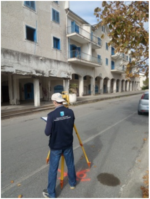
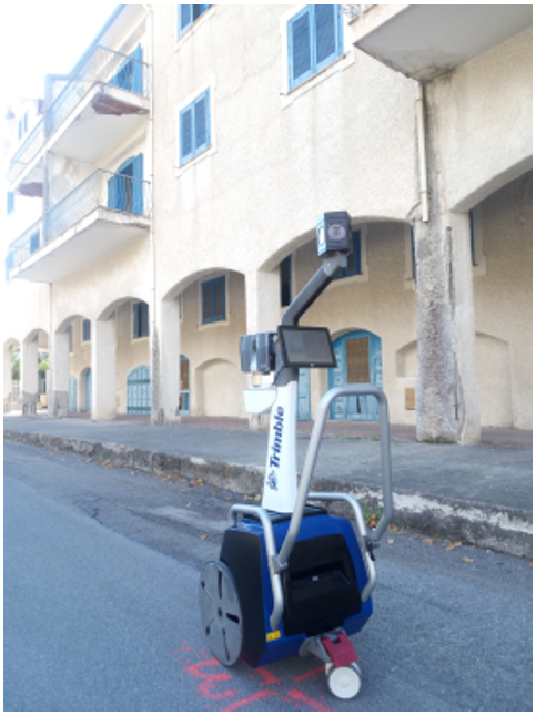
Left: Support point measurement stage. Right: TIMMS in the ground control point measurement stage.
WORKFLOW & RESULTS
When considering the complexity of the facility – with its numerous basements, and disconnected and irregular floor plan – a static 3D survey with the use of a static laser would have traditionally taken 3 to 4 weeks. Because of the intricate nature of this mapping project, around 130 ground control points needed to be captured on multiple levels, both inside the facility and along the entire external façade.
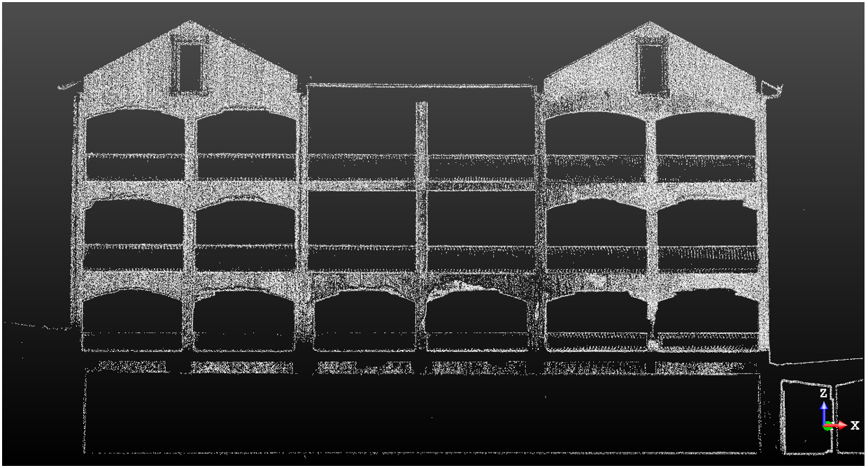
Above: Vertical cross-section of the façade - point clouds by reflectance.
TIMMS made it possible to survey the entire interior and exterior of Hotel Club Sangrilà, including capturing all of the ground control points, in just over four working days. All the scans were automatically registered in post-processing using the TPS software.
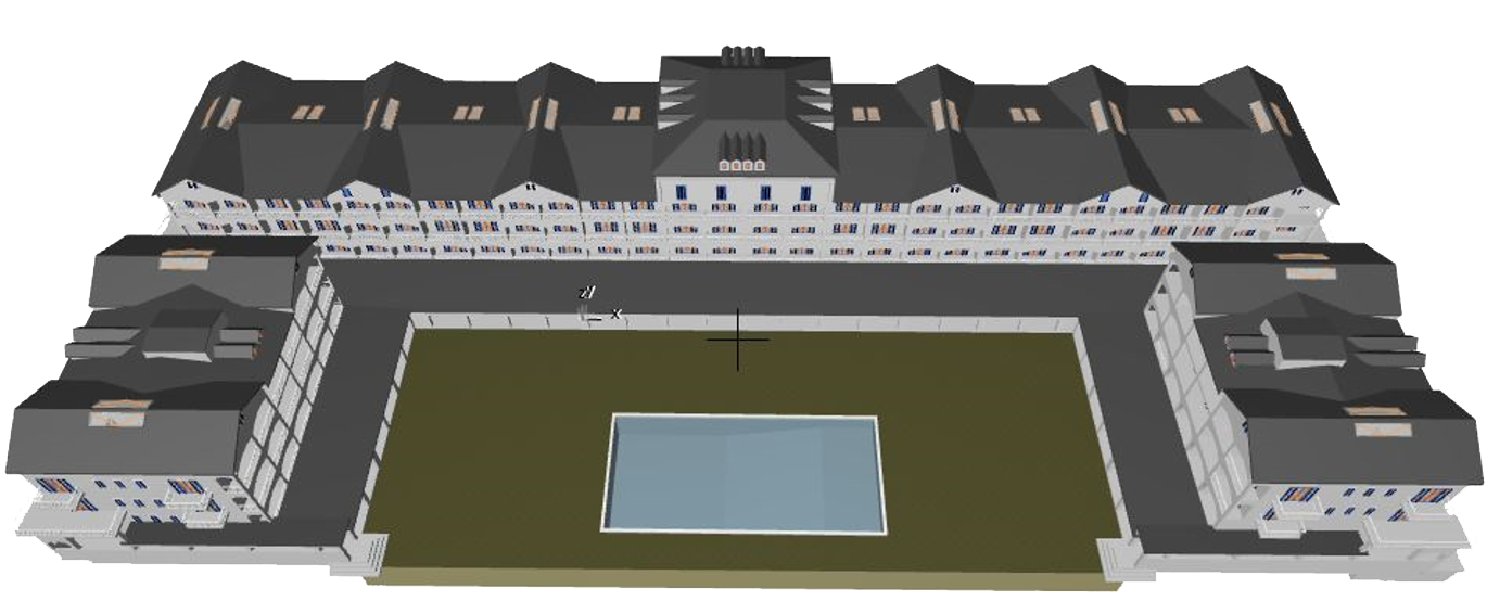
The data post-processing procedure, which was almost entirely automatic, generated point clouds for every single building, as well as their corresponding underground levels. The data, which included the roofs identified by the drone, were imported to the Trimble RealWorks software platform and “cleaned” by eliminating the areas of no interest. Again within RealWorks, vertical and horizontal sections relating to every single building were created. The results were imported to ArchiCAD (GRAPHISOFT) for the 3D modeling.
The final step before producing a 3D model was measuring the vertical distances between the outermost extents of the floors, again performed in Trimble RealWorks. This information was required to correctly define the irregularities between the individual floors in ArchiCAD.
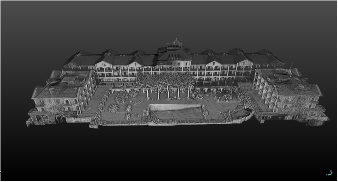
Pictured Top: TIMMS & UAV point cloud in Trimble RealWorks.
Bottom: 3D model reconstructed in ArchiCAD.
Special Thanks To:


Learn more about TIMMS from Applanix, A Trimble Company