POSPac›CenterPoint RTX
Achieve centimetre level accuracy without base stations when using Applanix POSPac with Post-processed Trimble CenterPoint® RTX™
Renowned accuracy, faster than ever without base stations
NEW
Experience faster convergence time in global RTX regions now with IN-Fusion+ PP-RTX 2
Available with POSPac 9, this second generation of IN-Fusion+ PP-RTX has new signal compatibility with Beidou-III satellites to achieve less than 3-minute convergence times in Global regions.
Note: This service is initially limited to uncrewed (UAV) airborne applications
|
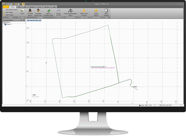
Applanix POSPac PP-RTX is a cloud-based global GNSS correction service that utilizes Trimble’s RTX technology to provide cm-level post-processed positioning accuracy without base stations. The Trimble RTX technology utilizes data from a dedicated global network of tracking stations to compute corrections to satellite orbit and clock information as well as atmospheric delay models. Applanix POSPac uses this data to post-process the GNSS-inertial trajectory and is an addition to the known SingleBase, SmartBase, and MultiSingleBase augmentation processing methods.
|
|
Map inaccessible regions that have no existing CORS without the cost of deploying local base stations | ||
Attain more uptime and reliability with Trimble’s professionally managed, highly maintained private network | ||
Achieve centimeter-level accuracy within minutes after mission completion | ||
Maximize productivity – reduce acquisition costs and rework costs | ||
Streamlined map production workflow – faster production and better accuracy |
Due to the mission size, crewed airborne projects can exceed the maximum of 20 km distance from a single base station required for a precise GNSS-Inertial solution. PP-RTX has no such limitation and is hence ideal for crewed aerial surveys. Since PP-RTX is a global service, it eliminates the cost and headache of setting up or procuring local base stations in different countries or remote locations
Short flights (10 – 30 minutes) can be processed using IN-Fusion PP-RTX while in Fast Region coverage, or with IN-Fusion+ PP-RTX 2 processing in the Fast or Global Regions as long as the proper signal tracking has been enabled. Longer flights (> 30 minute) can be processed in either region, and with either PP-RTX or PP-RTX 2 to obtain the same level of accuracy. This is particularly useful for BVLOS applications or longer linear flights such as those associated with corridor mapping. PP-RTX is also ideal for UAV mapping applications in remote regions such as mountainous and forested areas where existing base stations are not present, and setting up a base station can be difficult.
Applanix PP-RTX currently requires clean GNSS observables with minimal cycle slips and interruptions. Since land applications are typically exposed to frequent GNSS disruptions (buildings, vegetation, tunnels) in urban environments, the PP-RTX service will not achieve full accuracy. For missions in rural areas with no or only a few GNSS occlusions, it may produce adequate results. Contact Trimble Applanix for more details
The Applanix POSPac PP-RTX service can be used for all POS MV systems and applications. For offshore projects and remote coastal line surveys, it is the only cost-effective method for achieving centimeter level position accuracy. Surveys in ports or missions close to the mainland, POSPac PP-RTX eliminates the cost needed to procure or set up local base stations.
Trimble's industry-leading post-processing software, Applanix POSPac 9, integrates Trimble CenterPoint® RTX™ with post-processing – bringing the best of the Applanix IN-Fusion GNSS-aided inertial processing together with Trimble’s global correction service technology. The result is centimeter-level, post-processed positioning accuracies without base stations, in a platform completely optimized for mobile surveys that you can count on.
Features
Benefits
POSITION YOURSELF FOR SUCCESS
Contact Us
With unparalleled accuracy and a drive to help you succeed, our team of experts can support your most challenging applications.
|
Applanix POSPac Mobile Mapping Suite, now with IN-Fusion+, PP-RTX 2 and tuned LiDAR QC Tools, is our next generation, industry-leading software for Direct Georeferencing of mobile mapping sensors using GNSS and inertial technology. It is optimized for all environments and platforms (air, land, marine) and compatible with a variety of mapping sensors. This smart software solution achieves both maximum accuracy and maximum efficiency for Direct Georeferencing.
The Trimble CenterPoint RTX correction service is a high-accuracy, satellite-delivered global positioning service that is available across Applanix's entire product mapping portfolio. As a Trimble Company, Applanix is unique in the marketplace in its ability to offer this industry-leading performance and reliability. The Trimble CenterPoint RTX correction service yearly subscription is delivered by L-Band satellite or by the Internet. This breakthrough technology provides high-accuracy GNSS positioning without the use of traditional reference station-based differential RTK infrastructure. Benefit from more uptime, fast initialization, hardware savings, and more. Learn more on the Trimble Positioning Services website.