
With the rapid developments that are happening within the UAV survey and mapping segment, the lines between unmanned aerial survey and mapping, and manned aerial mapping are beginning to blur. However, it is not necessarily a matter of choosing UAVs for survey and mapping missions over manned aircraft, but rather determining where UAVs can augment the traditional manned aerial survey approach.
The use of UAVs in support of traditional manned aerial survey mapping projects is being driven by a number of key industry developments within the UAV domain. Three key developments standout, these include;
1) continuing improvements in onboard sensor payloads and UAV platforms,
2) the growth in regulations allowing Beyond Visual Line of Site (BLOVS) UAV mapping,
3) the availability of a new breed of GNSS/IMU systems for Direct Georeferencing (DG) that can be ‘integrated once and used many times’ on either manned or unmanned platforms.
Let’s look at these developments in more details:
Improvements in Aerial Imaging Sensors
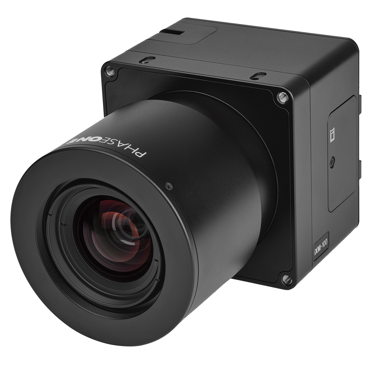
Perhaps the most rapid development taking place in the UAV industry today is the dramatic improvements witnessed in the development of new and improved imaging sensors. RGB cameras for example, are continually being introduced with smaller and lighter form factors while seeing continuing improvements in resolution and image quality. Some of these payloads, such as Phase One’s iXM 50 and 100 MP cameras (pictured) are producing results superior to previous generations of medium-format metric sensors being flown onboard manned aircraft. In essence, these sensor systems could be flown on either manned or unmanned missions. With this flexibility in the use of these new sensors the question then becomes which aerial platform manned or unmanned is most practical and cost effective for the specific mapping mission.
Similarly, LiDARs continue to improve with smaller more powerful point-cloud imaging systems. Some of the higher end, compact, professional mapping LiDAR’s such as those available from Riegl and Teledyne Optech, are light enough to be flown on UAV platforms, but more than capable of operating at higher altitudes from a manned platform such as a helicopter. As such, since these LiDAR imaging systems can be successfully operated on both platform, the challenge then becomes configuring and moving them between manned and unmanned platforms which can have inherently different DG accuracy requirements – more on this later.
Beyond Visual Line of Site (BLOVS) Mapping
Many UAV platforms technically have the capability to fly survey and mapping missions beyond visual line of site (BVLOS), and at higher altitudes above 400 feet. However, current regulatory restrictions prevent such flights without a special waiver required in many jurisdictions. The ability of these UAV platforms to fly high BVLOS make them useful for less expensive large area surveys. Furthermore, there is an entire category of larger scale UAVs that are specifically designed for longer duration flights at higher altitudes that may be more economical to fly when compared to manned airborne platforms. For example, helicopters have been used to acquire pipeline and transmission line imagery for many years. With a BVLOS waiver these missions could also be flown with a UAV. Again, whether to use a manned platform or an unmanned platform really depends on the requirements for the particular mission to be flown and comparative cost.
Cross-over GNSS/IMU Systems
One of the issues that was somewhat of a barrier to the use of imaging sensors for both manned and unmanned survey and mapping missions was the need to have separate GNSS/IMU solutions for both manned aircraft and unmanned platforms. Having to purchase separate GNSS/IMU solutions for Direct Georeferencing data from manned and unmanned aircraft is a cost barrier for many. No longer is this the case!
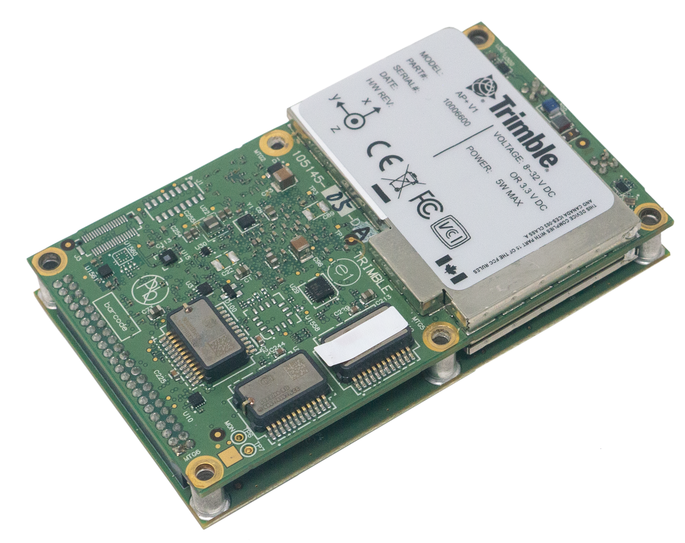
With the emergence of the Applanix AP+ Air GNSS/IMU, one system can be integrated with a suitable imaging sensor and used on a manned aircraft or aUAV. The new Trimble AP+ Air solution is smaller, lighter, and has lower power requirements making it suitable for use on UAV platforms, plus a flexible architecture including an on-board IMU and the ability to add higher accuracy external IMU’s when required for manned applications. These systems feature high performance multi-constellation, multi-frequency precision GNSS receivers and the industry leading Applanix IN-Fusion+ technology. The ability to simply move your sensor payload between platforms and applications without the need to have a specific DG hardware configuration for each platform, provides the flexibility required by systems integrators to embed a single solution that can then be configured to meet the different accuracy needs of a specific sensor type, whether flown on a UAV or manned aircraft. This in turn provides the end user market with exceptional flexibility and further option to reuse those often costly sensor payloads for a greater variety of airborne survey and mapping applications.
To wrap this up, the UAV survey and mapping industry is complementary to the manned aerial survey industry. It is all about selecting the right tool for any particular survey and mapping mission. However, with the ability to move sensor payloads in support of different application requirement, whether for UAV survey, or manned aerial mapping provides a new flexibility in use, and cost saving via ‘integrated once and used many times’.