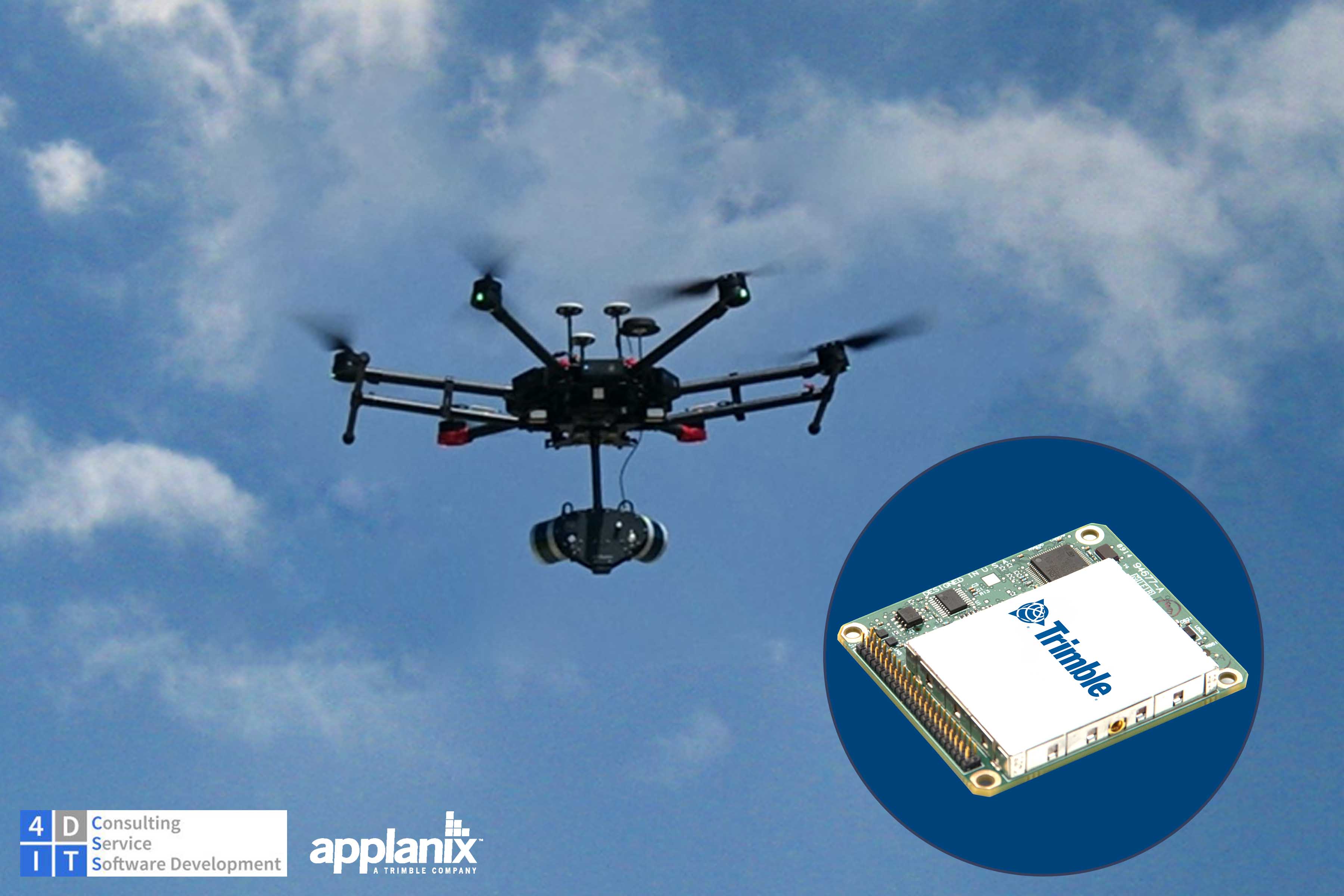
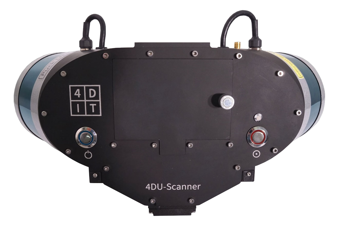
4D-IT GmbH wanted to create a solution for high-resolution, high-accuracy, colour 3D data acquisition. To do this, they partnered with Applanix’ team of engineers to take advantage of their Direct Georeferencing (DG) capabilities and expert knowledge of airborne mapping and sensor integrations. Using the APX-15 UAV and POSPac UAV for post-processing with a 32-channel profiling scanning system and RGB-sensors, the 4DU-Scanner was developed for many documentation and mapping tasks.
The Solution
- Turnkey professional UAV mapping system with Trimble APX-15 UAV
- Low weight and easy UAV-integration
- Greater area flown per mission, due to single-board GNSS-inertial DG solution which eliminates the need to survey extensive Ground Control Points (GCPs)1 and reduces the amount of sidelap needed
- Powerful post-processing software (POSPac UAV), including Applanix InFusion™ technology and support for SmartBase™
- 3D point-clouds ready to be fused with those acquired by other terrestrial or airborne sources
An integrated solution: LiDAR, RGB, and Applanix DG
The combination of the LiDAR and RGB sensors with Applanix’ industry-leading sensor technology offers a cost and time-efficient solution for various applications such as terrain modeling, vegetation mapping, geological mapping, documentation of pit-mining activities, land slide monitoring, and for high-quality 3D documentation of building facilities, industrial sites, or archaeology.
In the case of many applications, especially in topography-related environments with vegetation, LiDAR-based sensors are superior to camera-based systems because they are able to capture objects below the canopy. The weight of these sensors, as well as the typically higher demand on georeferencing, has been prohibitive for UAV-based applications of LiDAR in many cases, until now. The 4DU-Scanner overcomes these drawbacks with its low-weight construction, capturing of 32 simultaneous pro‑ les with different incidence angles, and supported by the capabilities of the lightweight APX- 15 UAV solution.
Applications
Topography
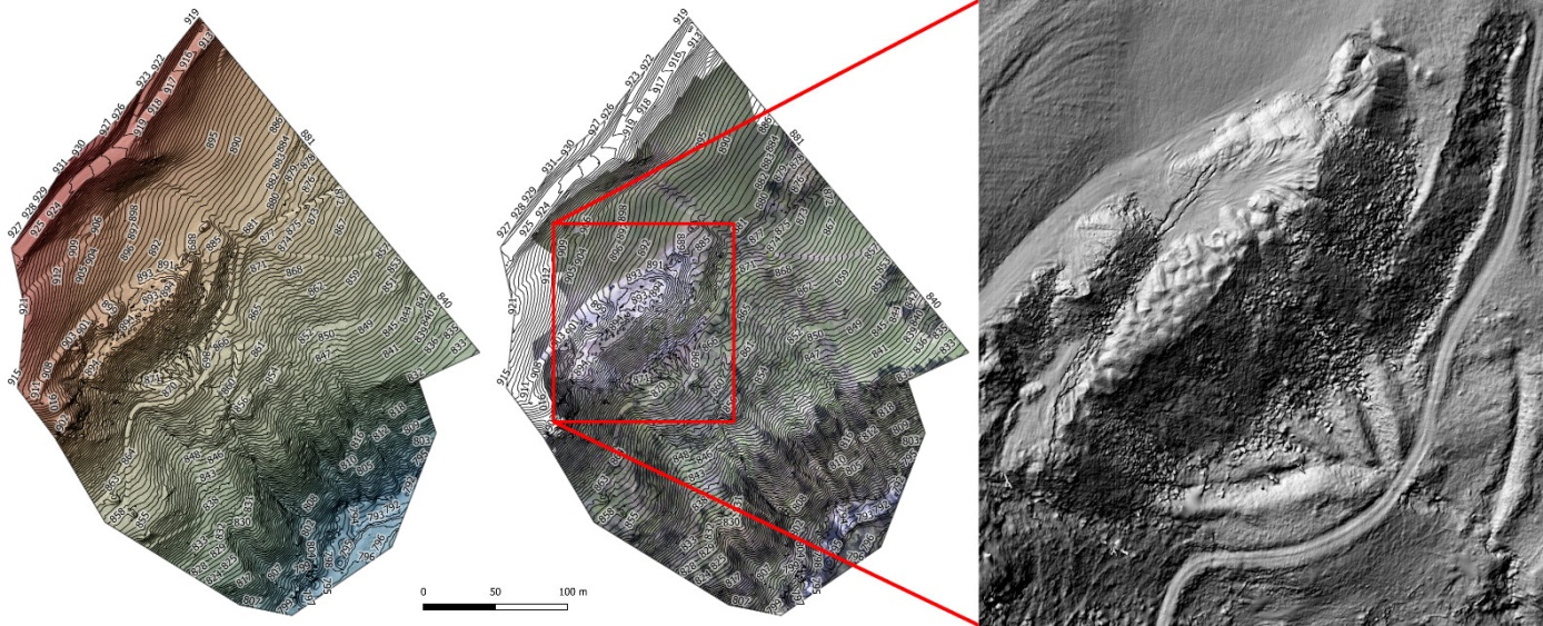
- Efficient and high-resolution terrain modeling
- Geological mapping and documentation
- Landslide monitoring
- Change detection
Forestry
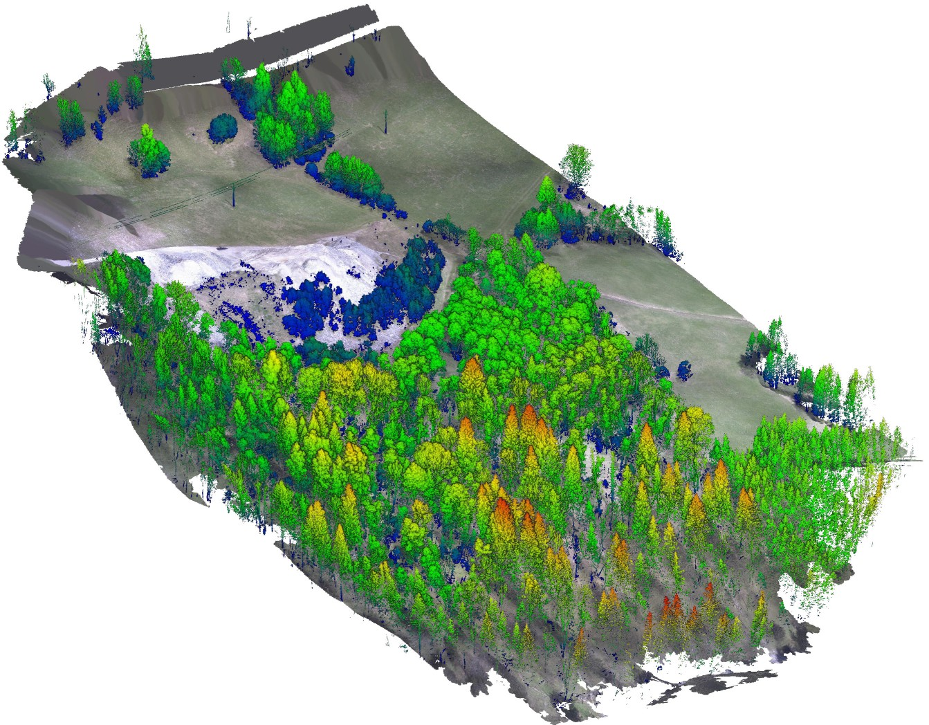
- Tree position and volume estimation
- Growth monitoring
Agriculture
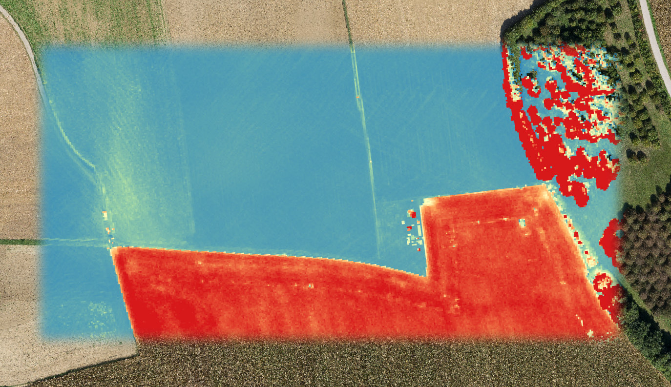
- Crop size estimation
- Plant monitoring
Infrastructure
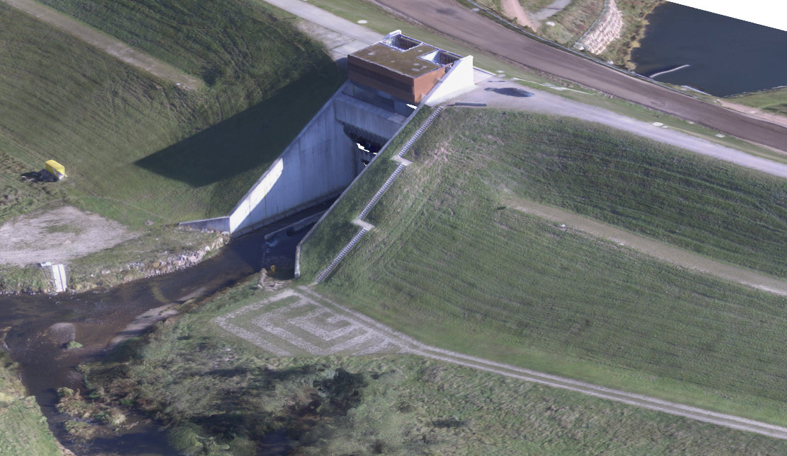
- Dam construction documentation
- Change detection
4DU-Scanner and APX-15 UAV capabilities
- Small, lightweight, and low-power GNSS-inertial components (6 x 6.7 cm, and only 60 grams), plus no separate IMU
- Centimeter-level accuracy and 5 cm point sampling distance
- Easy integration with commonly used UAVs, such as the DJI Matrice 600 Pro
- Complete solution including 4DU-S-Processor software for 2.5D and 3D modeling, analysis, and visualization
Open PDF
1 Dependent upon desired ground accuracy and sensor geometry