Navigation requires knowing the lay of the land; one’s position, heading, and speed; and how they are being affected by external forces. This is particularly true in the air and on the water, where there are no roads to constrain travel. All vehicles and vessels (boats, ships, etc.) are affected by the speed and direction of the wind; those on the water are also affected by currents and waves. (In the ocean, most currents flow in the general direction of the prevailing wind, so these problems tend to be additive.) A boat or ship’s helmsman or autopilot, an aircraft’s pilot or autopilot, and a UAV’s autopilot are constantly making small corrections to keep the vessel pointed in the right direction—yet none of them can keep precisely on course all the time. Additionally, a vessel’s heading and, ultimately, its course are affected by steering error.
If a remote sensing device—such as a multispectral camera or an imaging LiDAR—is rigidly attached to a vessel (as opposed to being gyro-stabilized), it is essential to know the direction in which it is pointing at any given moment. This requires knowing the vessel’s attitude (roll, pitch, and yaw).
Determining and tracking the position, heading, speed, and attitude of a vessel requires a combination of a GNSS receiver and an inertial measurement unit (IMU). Applanix systems integrate precision GNSS with advanced inertial technology to provide uninterrupted measurements of the position and attitude of moving vehicles and vessels.
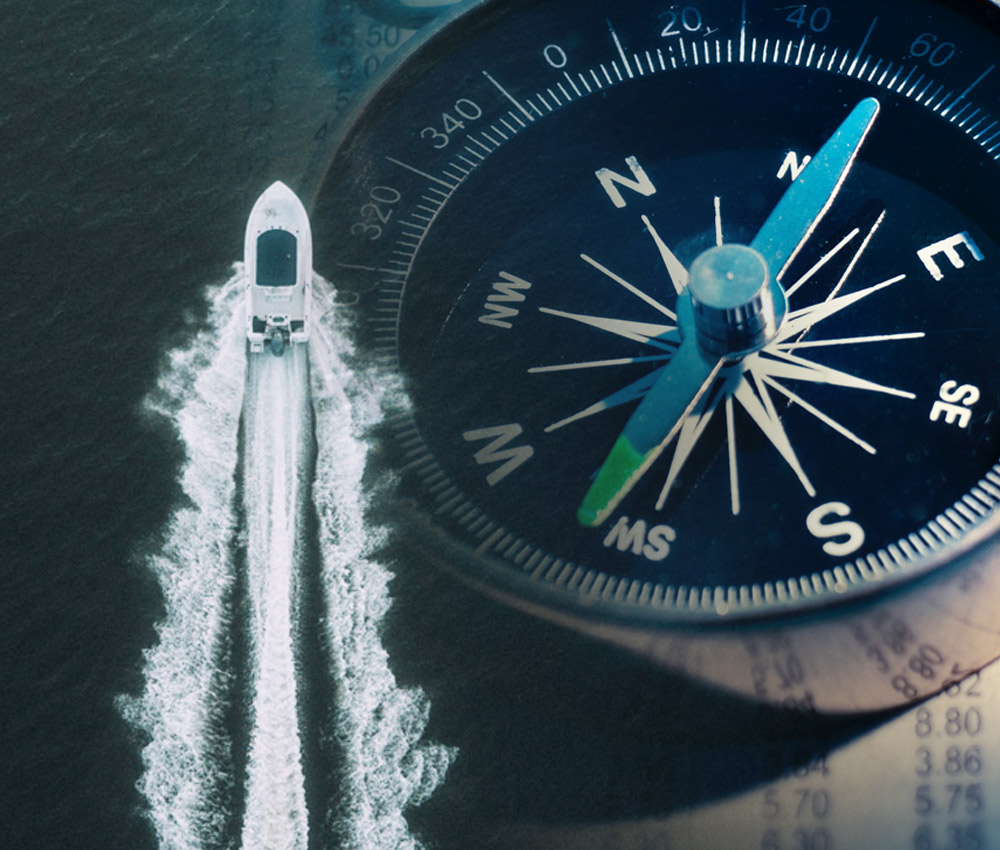
Course, heading, and bearing, are key navigation concepts.
Course
The course is the intended direction of travel. Ideally (but rarely) it is the same as heading. On a GPS receiver, the actual direction of motion is called course over ground (COG) or, on some units, track.
Heading
Heading is the direction in which a vehicle/vessel is pointing at any given moment. It is expressed as the angular distance relative to north, usually 000° at north, clockwise through 359°, in degrees of either true, magnetic, or compass direction. It is a constantly changing value as a vessel yaws back and forth across the course due to the combined effects of sea, wind, and steering error. For example, on a boat the helmsman may be trying to steer a course of 180°, but the heading one moment is 188° and the next moment it is 074°. The course remains 180°.
Typically, heading determination is the job of the IMU. However, only the best IMUs are able to do this well at low speed. In those circumstances, a GNSS device with two antennas can be used instead.
Bearing
A bearing is the direction from one place to another, measured in degrees of angle with respect to an accepted reference line. When using compass bearings, the reference line is north, so “the lighthouse is on a bearing of 270°” means “the lighthouse is to the west of us.” When using relative bearings, the reference line is the vessel’s centerline. So, dead ahead is 000° and a buoy abeam to starboard (which is nautical terminology for “at 90° to the right when you are facing forward”) bears 090°. GPS receivers provide a continuously updated bearing to an active waypoint.