
Applanix DG for UAV Product Portfolio
Fully Supported With
Direct Georeferencing for UAV Products & Services
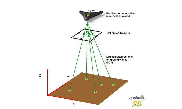
Direct Georeferencing or DG directly measures the position and orientation of an airborne mapping sensor, such as a digital camera or a laser scanner. Thereby making it possible to assign a geographical location on the earth to a pixel from a camera image or a digital point from a laser, without the need for ground control points or any additional measurements referencing the ground.
- Worry-free solution built for all environments
- Rugged, yet lightweight hardware
- Powerful, but not power-hungry technology
- Custom designed components engineered to tightly integrate all of the enabling technologies
- Proven accuracy
- Global support
To compute the position and orientation of an imaging payload to a very high degree of accuracy and precision, our DG solutions use multi-frequency, multi-constellation RTK and post-processed carrier phase Differential GNSS tightly integrated with calibrated inertial sensors.
For Photogrammetric Applications
The Exterior Orientation (EO) of each image is pre-computed before any point-matching or adjustment phase. Unlike a PPK position-only DGNSS solution, having the full position and orientation of the payload eliminates all issues associated with: automatic project set-up, failed point matching, and reduced sidelap.
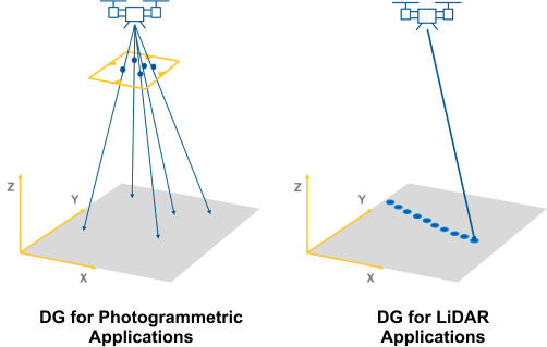
For LiDAR Applications
Direct Georeferencing for LiDAR directly measures the position and orientation of the LiDAR with respect to the earth. This means the 3D coordinates of a point cloud computed from the LiDAR ranges and angles can be directly assigned a geographical location on the earth, without the need for ground control points or any additional measurements referencing the ground.
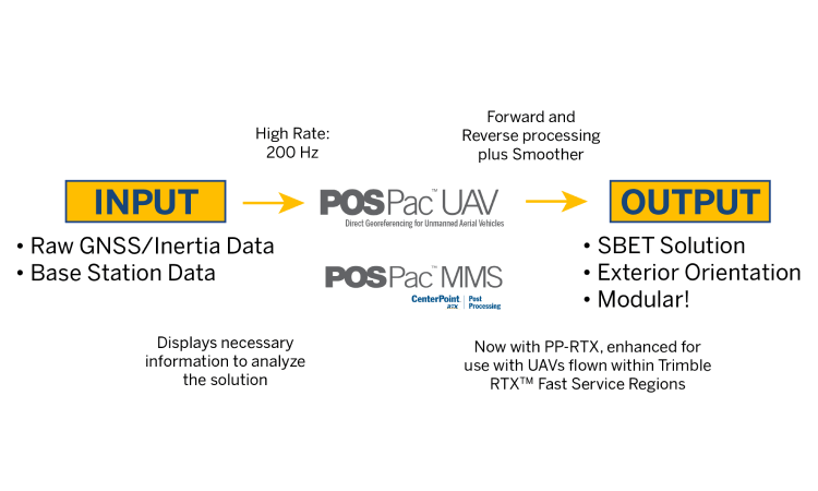
Our DG solutions work with all mapping sensors, including: RGB cameras, NIR cameras, Thermal cameras, LiDAR, SAR, Multispectral and Hyperspectral cameras. The georeferencing can be done in real-time or, for highest accuracy, in post-mission using Applanix POSPac MMS Software.
We Work With the Best Partners
While we are at the forefront of and specialize in high-quality GNSS-inertial boards, when you purchase our boards, we join your team to help you achieve your project goals. Here are just a few of the many amazing companies we're proud to consider partners.
![]()
![]()
![]()

![]()
![]()

![]()
The Applanix DG solutions for UAV’s are comprised of high performance, compact GNSS-Inertial hardware designed specifically for UAV’s, and industry leading post-processing software for generating the data required to georeference each pixel or point from a mapping sensor.
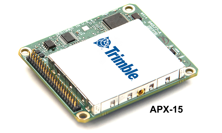
Trimble APX-15 UAV: Single board GNSS-Inertial solution for DG from small UAVS
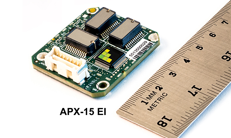
Trimble APX-15 EI UAV: Support for an external IMU for gimballed platform
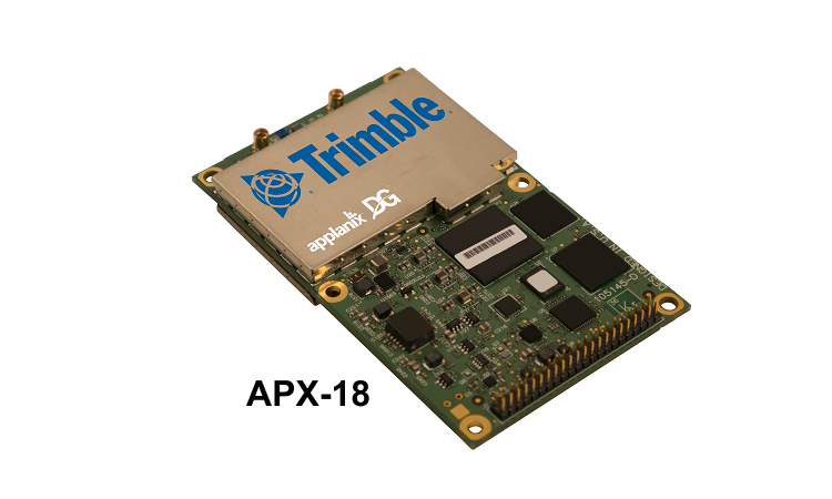
Trimble APX-18 UAV: Dual GNSS antenna configuration for low speeds/hovering, LiDAR
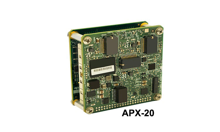
Trimble APX-20 UAV: External IMU for highest accuracy and higher altitude mapping
Trimble POSPac UAV: Post-processing SW for DG on UAV's
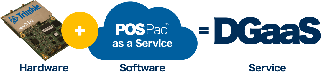
Direct Georeferencing as a Services (DGaaS) is a new OEM product offering that includes Trimble APX-UAV hardware as a service, which features a special firmware license for processing your UAV data on a pay-per-use basis in the Cloud.
Hardware as a Service
What’s available: Trimble APX-15 UAV, Trimble APX-15 EI UAV, Trimble APX-18 UAV, and Trimble APX-20 UAV
Software as a Service
What’s included: Applanix POSPac UAV Cloud API for Post Processing, OEM Interface App and Applanix POSPac as a Service
GNSS augmentation (See Webinar) is required to generate cm level absolute position accuracy for mapping applications. The Applanix GNSS augmentation solutions guarantee the highest level of accuracy, are simple to use, cost-effective, and seamlessly integrated into the APX UAV Direct Georeferencing workflow.
Applanix SmartBase™: generates a set of observations for a virtual base station exactly where and when you need it!
Applanix POSPac Post-processed Trimble Centerpoint™ RTX (PP-RTX®) Correction Service: Centimeter positioning without base stations
Applanix POSPac UAV®: GNSS-aided inertial post-processing software for georeferencing data from the Trimble APX series of board sets.
Applanix POSPac® LiDAR QC Tools: Comprised of a set of Applanix POSPac software tools developed by Trimble Applanix to achieve the highest level of georeferencing accuracy with a UAV based LiDAR payload integrated with the Trimble APX UAV GNSS-Inertial products.
MORE ON Applanix LiDAR QC TOOLS
ApplanixPPK: An easy-to-use Web App Cloud Service to post-process kinematic Differential GNSS position for UAVs and drones. The ApplanixPPK Cloud processing runs the GNSS trajectory refinement which supports your drone mapping applications.