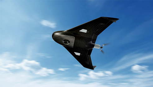
A New Industry Takes Off!
Just six years ago, unmanned aerial systems (UAS) were a novelty in the world of geospatial technologies—often dismissed as either too expensive to be useful to aerial mapping companies (with $250,000 Predator drones in mind) or as cheap toys not up to the challenge of professional mapping. Now, they make up a large new industry. In the past couple of years, the price of small UAS (sUAS) has dropped dramatically and now there are thousands of sUAS platforms available, ranging from fixed-wing to rotary-wing, open-source to commercial, consumer grade to professional. The Federal Aviation Administration (FAA) has registered more than 750,000 UAS and certified more than 25,000 remote pilots. It has estimated that as many as 7,000,000 drones of various types will be purchased in the United States by 2020.
UAS are now used routinely for a wide range of geospatial applications, especially aerial mapping and inspection. Soon, title companies and developers will come to expect a host of aerial-derived products—such as DEMs, orthophotos, and infrared imagery—along with boundary surveys. From construction to conservation, from humanitarian relief efforts to precision agriculture, from change detection to search and rescue, UAS are fundamentally changing our world.
FAA Rules
Since the advent of UAS, the FAA has been under tremendous pressure to open the national air space (NAS) to them. Under the FAA Modernization and Reform Act of 2012, Congress directed the FAA to integrate UAS into the NAS. In February 2015, the agency promulgated a draft set of rules for commercial operators to obtain exemptions under Section 333 of the act. The first to apply for these exemptions were Hollywood filmmakers; later, the FAA granted exemptions for select geospatial firms, including Trimble Navigation and Woolpert. However, the hurdles and uncertainty associated with securing a Section 333 exemption severely hampered the development of the UAS market.
In August 2016, the FAA’s final rule for sUAS, Rule 107, went into effect. It provides specific safety regulations for non-recreational use of UAS weighing less than 55 pounds. Now, the legal requirements for commercial UAS operations are clear and the threshold to do so has been reduced considerably.
Prior to Rule 107, flying a UAS for commercial purposes required a pilot’s license. Under 107, an operator takes a test, is vetted by the Transportation Security Administration (TSA), and becomes a remote pilot in command (RPIC). The aircraft must weigh less than 55 lbs or be registered and it must undergo a pre-flight safety check. It may only operate in class G airspace and must be kept in visual line-of-sight. It must fly under 400 ft., during the day, and at or below 100 mph. It must yield to manned aircraft, not fly over people, and not fly from a moving vehicle.
While flights beyond visual line of sight (BVLOS) are technically still prohibited, the FAA may waive that restriction if they can be accomplished safely—for example, for powerline inspections. A long-awaited proposed rule for operations over people, originally to be published before the end of 2016, has been delayed.
Rule 107 allows commercial package delivery only if the operator, in addition to complying with all the requirements listed above, secures external loads in such a way that they do not adversely affect the aircraft’s flight characteristics or controllability, ensures that the loaded aircraft weighs less than 55 lbs. at takeoff, and does not cross state boundaries.
Future Rules
In June, the House’s Transportation and Infrastructure Committee passed a legislative package that directs the FAA to develop a rulemaking process to certify UAS traffic management services, opening a pathway for an operational UAS Traffic Management (UTM) system. It also establishes an exemption process for deploying UTM in low-risk areas, such as in lower-level altitudes over cropland, and other areas that are away from congested airspace. NASA, building on its legacy of work in air traffic management for crewed aircraft, is researching prototype technologies for such a UTM system—such as airspace design, dynamic geofencing, congestion management, and terrain avoidance.
It appears that Congress has embraced the need to enable full UAS integration, including BVLOS operations, flights over people, access to higher altitudes, and even package delivery. However, beyond flight safety, which is the FAA’s purview, states have begun to legislate what UAS may do—thus shifting the policy discussion and political battles about UAS from Congress to state legislatures.