The AMS
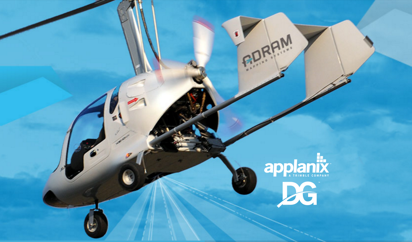
AMS is the only commercially available system worldwide that was designed from the ground up to be used in ultralight aircraft (ULA), including gyrocopters. Marcin Prochaska, R&D Director for ADRAM, says “From the start we designed the AMS as a “One Man Mission System” for an ultralight, meaning the pilot is also the operator. To fully realize the benefits of ULAs we had to get rid of an operator. Doing so saves more than 70 kgs of weight and means we can use passenger space for the mapping system.” This design saves a lot of money for every airborne mapping project. To make it work, special design of the Flight Management System (FMS) was necessary. Prochaska continued, “We spent hours of research time discussing with several ULA pilots what information they need from an FMS and they kept answering “none” so we designed a pilot’s interface to be as simple as possible. It has a clear map view and some simple status sensor views (IMU, camera and scanner). With this design the pilot is not distracted by unnecessary data. It’s simple and effective.” The system is removable, fitted in ultra-rigid frame. The frame keeps all sensors tight together and protects them. It can be easy moved from one aircraft to another. 3-years of research and development has culminated in the revolutionary ADRAM Airborne Mapping System onboard an ultra-light gyroplane. With low investment & operational costs, the AMS maximizes productivity and versatility in professional grade aerial mapping. AMS is an excellent cost-effective alternative to expensive fixed wing aircrafts and helicopters, and is highly competitive with UAVs. AMS integrates the Trimble AP50 GNSS-Inertial system for continuous mobile positioning and Direct Georeferencing (DG). Adram AMS can also be delivered together with full 3 axis stabilization, which is unique feature on the market.
The Trimble AP50

The Trimble AP50 is an embedded GNSS-Inertial OEM board set plus Inertial Measurement Unit (IMU) in a compact form factor. It is designed to give system integrators the ability to harness the best in GNSS multi-frequency positioning technology, with the superior capabilities of inertial data for continuous mobile positioning in poor signal environments, and for the orientation of imaging sensors.
Payload Components
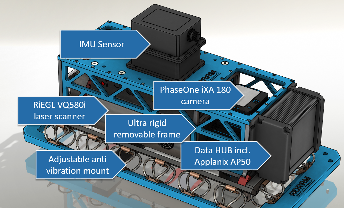
The AMS payload is customizable and upgradeable, meaning that any system component i.e. sensor can be replaced with newer and more advanced components at any time. The ADRAM Open Sensor Platform allows all kinds of set-ups with many sensor combinations including laser scanner, photogrammetric camera and 4 oblique cameras at once. It can also be easily equipped with a stabilized mount.
Results
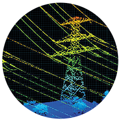
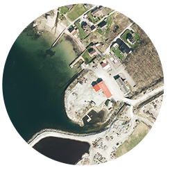
For aerial imaging using a PhaseOne iXA 180 camera, high image sharpness and high dynamic range colors are attained with pixel up to 1 cm. With a Riegl VQ-580 laser scanner, up to 70 pts/m2 and 100+ m range is attained. “The state of the art Applanix GNSS-Inertial system means the AMS delivers top accuracy and high density LiDAR data, even on snow and ice,” said Prochaska. “Applanix is the word leader in DG, and DG makes this system the powerful mapping solution it is. Applanix is a wonderful partner. They have provided the excellent support throughout this process. The accuracy and performance of their technology is second to none. And their products are very, very reliable. It’s been an excellent experience working with them.” For more information on ADRAM please visit their website.