Visit us at Xponential 2024, Booth 5507

April 22-25, 2024  | San Diego, CA, USA


Not Beyond Our Line of Sight

Tomorrow's emerging technologies with today's inertial expertise makes your UAV soar

Trimble Applanix develops, sells, and supports stable, reliable, and repeatable GNSS-inertial solutions that enable mobile mapping from air, land, and marine vehicles – including urban air mobility for drones. They are easy to integrate and designed to operate under the most difficult conditions. 

Whether the mission is advanced surveying beyond visual line of sight (BVLOS), or mapping in challenging GNSS-obstructed environments, Applanix Direct Georeferencing technology delivers powerful, consistent results against lofty expectations. 

Check out our current Applanix DG line of OEM boards designed specifically for professional mapping with a UAV, and the latest version of POSPac MMS, all on display at Xponential.


What's New 

Trimble PX-1 RTX – A small, lightweight GNSS-Inertial module with Trimble CenterPoint® RTX corrections, Trimble PX-1 RTX delivers consistent navigation without additional infrastructures.

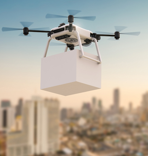
Drones are quickly revolutionizing the way we deliver goods and transport people by providing a cost effective and environmentally friendly alternative to traditional methods. Automating drones requires accurate, reliable, continuous positioning and heading in all environments to avoid putting goods and people at risk.

Get hands-on time with Trimble’s new positioning solution for drones which provides unparalleled accuracy and performance.


Program Sessions

Trimble Applanix High Performance Solutions for UAV Mapping and Autonomy

Date: Tuesday April 23, 2024 | 1:30 PM - 1:55 PM
Room: Solutions Theater - Xpo Hall | Session Number XPO24-ST-0718

Speakers:
Francesco Martinelli | Land Sales and Business Development Manager, Trimble Applanix
Jerry Wang | Product Engineer, Trimble Applanix

About: This presentation will explore how integrating multiple sensors can enhance mapping and autonomous navigation across air, land and marine platforms, both indoors and outdoors. Learn more.


Skip the Line-Ups

Book a one-on-one meeting with a Trimble Applanix representative in advance, for expert advice on how our solutions can address your specific needs.  We’ll answer your questions, and direct you to the product most suited for you.

We look forward to seeing you there!


Book a one-on-one discussion with our on-site staff


What We're Showing


APX Family of OEM Boards

Applanix POSPac MMS

Introducing Applanix POSPac 9: Unleash New Possibilities! Learn about our next generation, industry-leading software for Direct Georeferencing of mobile mapping sensors using GNSS and inertial technology. Applanix POSPac 9 is designed to take your mobile mapping projects to new heights. Now with IN-Fusion+ Processing Mode & Tuned LiDAR QC Tools, get ready to unleash new possibilities with our industry-leading software for mobile mapping.

Learn More about Applanix POSPac MMS >


Applanix LiDAR QC Tools

Applanix LiDAR QC Tools

Applanix LiDAR QC Tools are a set of Applanix POSPac software tools that achieve the highest level of georeferencing accuracy with LiDAR sensors. Applanix LiDAR QC Tools support boresight calibration between IMU and LiDAR sensor, trajectory adjustment and LAS file point cloud generation. It is available for uncrewed airborne and mobile mapping leveraging LiDAR SLAM as an aiding sensor. 

Learn More about LiDAR QC Tools > 


Applanix POSPac PP-RTX

Applanix POSPac with Post-processed Trimble CenterPoint® RTX™ (PP-RTX)

Applanix POSPac PP-RTX is a cloud-based global GNSS correction service which utilizes Trimbles RTX technology to provide cm-level post-processed positioning accuracy without base stations. The Trimble RTX technology utilizes data from a dedicated global network of tracking stations to compute corrections to satellite orbit and clock information and atmospheric delay models. 

Learn More about Applanix POSPac PP-RTX >


NEW! Experience faster convergence time in global RTX regions now with IN-Fusion+ PP-RTX 2, available with POSPac 9, the second generation of PP-RTX. Using the new BDS-III generation signals, B1C and B2A, improves convergence and accuracy, hence making it suitable for short uncrewed airborne flights outside of the fast regions. 

Read Whitepaper >


APX Family of OEM Boards

Direct Georeferencing for UAVs: APX and AP+ Air Family of OEM Boards 

Our GNSS-inertial technology is designed to reduce the cost and improve the efficiency of aerial survey from UAVs by Directly Georeferencing each point of sensor data without extensive GCPs (Ground Control Points) or flight line overlap.

Learn More about our Direct Georeferencing for UAV Applications >

Learn More about our Direct Georeferencing for Aircraft Applications >


Aerial view of cars driving on highway

Land Mobile Mapping

Introducing Trimble AP+ Land , for high accuracy, low power and size. Accurately and efficiently track and monitor fleets, produce high-definition (HD) maps and 3D models, or act as a reference solution for advanced driver-assistance systems (ADAS) testing, no matter the GNSS environment with Applanix solutions for land mobile mapping.

Learn More about Applanix Land Mobile Mapping >


APX Family of OEM Boards

Trimble PX-1 RTX for Advanced Air Mobility: Precise Positioning as a Service

The Trimble PX-1 RTX is a small, lightweight GNSS-Inertial module that allows drone integration companies to add precise positioning as a service capabilities to their drone delivery systems so that operators can more efficiently plan and execute takeoff, navigation, and landing tasks. Trimble's positioning solutions provide unparalleled accuracy and performance, so your drone can navigate through whatever crosses its path.

Learn More about the Trimble PX-1 RTX >